ISPRS ICWG III/II
Planetary Remote Sensing and Mapping
ISPRS Inter-Commission Working Group “Planetary Remote Sensing and Mapping” aims to promote the development of new methodologies, algorithms, and applications related to remote sensing, photogrammetry, and mapping of extra-terrestrial planetary bodies. To this purpose, the group will organize workshops, symposiums, and other activities to exchange the latest developments in this field. Furthermore, the WG will promote international cooperation on cross-validation and integrated processing of remote sensing data from multiple planetary missions for science applications.
Working Group Officers | ||
Chair | ||
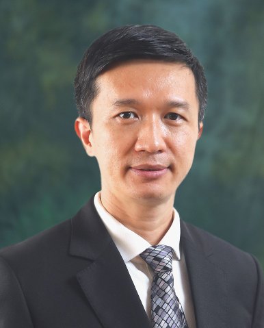 | Bo Wu Research Centre for Deep Space Explorations Department of Land Surveying & Geo-Informatics The Hong Kong Polytechnic University Hung Hom, Kowloon, Hong Kong CHINA +852 2766 4335
| |
Co-Chair | ||
 | Prasun Mahanti Lunar Reconnaissance Orbiter Camera Science Operations Center School of Earth and Space Exploration Arizona State University Tempe, AZ 85287-3603 USA +1 480 727-7999
| |
Co-Chair | ||
 | Irina Karachevtseva MIIGAiK Extraterrestrial Laboratory (MExLab) Moscow University of Geodesy and Cartography (MIIGAiK) Gorokhovsky pereulok, 4 105064, Moscow RUSSIAN FEDERATION +7 499 267-35-13
| |
Secretary | ||
 | Cristina Re Italian National Institute for Astrophisics (INAF) Astronomical Observatory of Padova 35100 Padua, Veneto ITALY +39 0498293412
| |
Supporters | ||
Advisor | ||
 | Kaichang Di Aerospace Information Research Institute Chinese Academy of Sciences (CAS) PO.Box 9718, Datun Road, Chaoyang District Beijing 100101 CHINA + 86 10 64868229
| |
Advisor | ||
 | Jürgen Oberst German Aerospace Center Institute for Planetary Research Planetary Geodesy Rutherfordstrasse 2 D - 12489 Berlin GERMANY +49 30 67055 336
| |
Advisor | ||
 | Randolph Kirk Astrogeology Science Center U.S. Geological Survey 2255 N. Gemini Dr. Flagstaff, Arizona 86001 USA +1 928 890 4823
| |
Terms of Reference
- Develop new methodologies and algorithms for sensor calibration, data fusion and information extraction from planetary remote sensing data
- Develop advanced techniques in planetary photogrammetry and robotic vision for the mapping of celestial bodies
- Evaluate and refine reference systems, coordinate systems, control networks, map sheet definitions, etc. and their standardization
- Develop new algorithms for detection and recognition of geomorphological features on planetary surfaces and study their scientific implications
- Develop spatial information systems to support extra-terrestrial exploration and science
- Cooperate with related planetary mapping and exploration working groups in space agencies and international organizations
News:
[01-03-2024]: The ISPRS Technical Commission III Mid-term Symposium on Remote Sensing will be held in Belém, Brazil, 4-8 November 2024. The ISPRS ICWG III/II "Planetary Remote Sensing and Mapping" will organize a workshop on "Planetary Science" at the Symposium.
Import Dates:
- Abstract/Paper submission deadline: April 15, 2024
- Notification Authors: May 30, 2024
- Early registration deadline: June 30, 2024
- Camera-ready Papers: July 15, 2024
- Standard registration deadline: September 30, 2024
Abstract/Paper Submission Website: https://www.conftool.org/belem-2024-tc3-symposium/
Please select "Planetary Science" among the topics listed when submitting.
[20-05-2023]: A workshop on "Deep Space Explorations" was organized at the Hong Kong Polytechnic University (PolyU) on 10 May 2023 during the PolyU Academy for Interdisciplinary Research (PAIR) Conference 2023. Speakers from the University of Hong Kong, Macau University of Science and Technology, Institute of Geology and Geophysics of the Chinese Academy of Sciences, Wuhan University, PolyU, and other institutions delivered presentations on different topics including lakes and seas on Mars, Chang’E-5 sample analysis, Martian atmospheric studies, geologic study of the lunar South Pole, mechanical properties of planetary rocks, etc. The workshop attracted more than 70 researchers of different background in the planetary community to attend, and fruitful discussions facilitated potential future multidisciplinary collaborations.
[27-03-2023]: ISPRS Journal of Photogrammetry and Remote Sensing - Special Issue on “Planetary Remote Sensing and Mapping”, 2023/24, ongoing.
[08-02-2023]: A Technical Committee on Deep Space Remote Sensing and Geomatics of the Chinese Society for Geodesy Photogrammetry and Cartography was established in December 2022, to promote the advancement of remote sensing, surveying and mapping technologies for deep space exploration in China. Read more information from here.
(If you are interested to join the ICWG III/II "Planetary Remote Sensing and Mapping" as a member, please send an email request to bo.wu at polyu.edu.hk for follow up.)
ICWG III/II
