ISPRS WG IV/2
Artificial Intelligence and Uncertainty Modeling in Spatial Analysis
Our Mission
We are rapidly entering into an unprecedented “geospatial data governance era”. Our working group argues that we must seize the opportunity to intelligently collect and retrieve these diverse geospatial data and use spatial analysis, spatial statistics and artificial intelligence (AI) methodologies like deep learning to address pressing environmental and socioeconomic challenges requiring solutions at local to global scales. A particular issue concerns the uncertainty and quality of these data. The data are produced either by official organizations or volunteer citizens (crowdsourcing). A great diversity of data is available, including data produced via space-based, airborne-based, ground-based, and human-based sources. Smart fusion and assessment of data collected from space- and air-borne sensors, geosensors, biosensors, and human sensors, including volunteers, social networks, and crowdsourcing, is challenging, which represents technical barriers to addressing the pressing problems. While spatial data are arguably “big spatial data”, like in remote sensing images, the current context is especially critical, as smart collection, integration, and analysis of big geospatial data are increasingly impacted by the seven V’s: volume, velocity, veracity, validity, value, variability, and variety. Intelligent decision made on the basis of big geospatial data are therefore best to be aware of the uncertainties inherent within these data. The vast availability of geospatial data of an ever increasing fine spatial and temporal resolution has resulted in big data volumes, and challenged the GIScience communities to develop smart artificial intelligence (AI) algorithms that are suitable for addressing numerous emerging global societal challenges. These include challenges in the areas of climate change, water, and food security, energy, health, biodiversity, and social well-being. Fortunately, open-source technologies can contribute to facilitate this goal by developing and sharing transparent, out-of-the-software-box, open science tools available for everyone. Furthermore, the progress in AI, semantics, and spatial as well as spatio-temporal statistics provides novel opportunities that allow for the smart leveraging of massive spatial data beyond the existing approaches to explore and assess new information, pattern, and knowledge. In our working group we aim to further develop intelligent methodologies e.g. for data fusion and integration. In this way, we will be optimizing reliable spatially referenced information extraction and to model and assess their contributions to informed decision-making that addresses environmental and socioeconomic challenges facing society in the 21st century.
Working Group Officers | ||
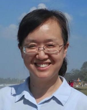
Chair | ||
 | Yong Ge Key Laboratory of Poyang Lake Wetland and Watershed Research Ministry of Education Jiangxi Normal University Nanchang 330022 CHINA
| |
Co-Chair | ||
 | Gerhard Navratil Dept. of Geodesy and Geoinformation, TU Wien Gußhausstr. 27-29 / E120 (CD0342) Wien, 1040 AUSTRIA +43(1)58801 12712
| |
Co-Chair | ||
 | Umit Işıkdag Department of Informatics, Mimar Sinan Fine Arts University, Bomonti Kampüsü Cumhuriyet Mah. Silahşör Cad. No:89 Bomonti Şişli, İstanbul TÜRKIYE +90 212 246 00 11
| |
Secretary | ||
 | Inger Fabris-Rotelli Department of Statistics University of Pretoria Lynnwood Road Hatfield Pretoria SOUTH AFRICA +27 (012) 420-5420/ 082 470 8480
| |
Supporters | ||
Advisor | ||
 | Mahmoud R. Delavar Centre of Excellence in Geomatic Eng. in Disaster Management, and Land Administration in Smart City Lab., School of Surveying and Geospatial Eng., College of Engineering University of Tehran P.O. Box: 11155-4563, Tehran IRAN
| |
Advisor | ||
 | Alfred Stein University of Twente Drienerlolaan 5 7522 NB Enschede NETHERLANDS +31 53 489 9111
| |
Terms of Reference
- Data mining, machine learning and artificial intelligence methods applicable to spatial and spatiotemporal data, spatial analysis and spatial statistics and their assessment
- Spatial statistics for uncertainty assessment
- Methods to intelligently assess quality of spatial decision-making processes
- Challenges in smart big spatial data collection, fusion, mining, and assessment in GIScience
- Advance knowledge in implementing, customizing and optimizing the artificial intelligence algorithms for spatial analysis, spatial statistics and uncertainty modeling
- Intelligent assessment of the reliability, quality, and liability of spatial data and spatial analyses
- Leveraging artificial intelligence in spatial analysis and spatial statistics operations and their uncertainty modeling
- Development of robust software tools for uncertainty modelling and visualization such as Data Uncertainty Engine (DUE)
- Uncertainty modelling in indoor, outdoor and seamless environment, real-time processing; control and obstacle avoidance and dynamic scene understanding
- Validation of new sensors and their calibration, fusion as well as information extraction and their combinations
- Data quality and uncertainty assessment in multi-dimensional GIS and multi-concept remote sensing of big datasets related to natural and/or built environment
- Developing and implementing appropriate, comprehensive, intelligent and generally accepted quality control techniques and data quality standards
- Uncertainty assessment in dynamic geospatial services, deep web, linked data, online multidimensional visualization considering usability, designs for mobile web, seamless indoor/outdoor location-based services, community-driven and participatory applications, and global information services
UPCOMING EVENTS
ISPRS Geospatial Week 2025
In Dubai, UAE 6 - 11 April 2025. More Information
JOURNAL SPECIAL ISSUES
3D Digital Modelling with Domain Knowledge - More Information
Quality of Smart Multidimensional Spatial Modeling - More Information
Advances in 3D Reconstruction with High-Resolution Satellite Data, in Remote Sensing - More Information
PAST EVENTS
Webinar: Prof Robert (Gil) Pontius 13 August 2024
WG IV/2


