Weekly Webinar Series 2024 - Remote Sensing for the Hydrosphere and Cryosphere
Remote Sensing for the Hydrosphere and Cryosphere
June 26 – August 21, 2024
(Every Wednesday – except July 17, 2024)
In association with Indian Society of Remote Sensing
Register
Program:
June 26, 2024 (0400 – 0430 am UTC / 0900 – 0930 pm PST)
Introduction of Webinar Theme “Remote Sensing for the Hydrosphere, and Cryosphere” by Dr. Laurent Polidori, President, ISPRS TC-III – Remote Sensing / Dr. Praveen K. Thakur, Chairman ISPRS WG III/7
Webinar Moderation: Dr. Praveen K. Thakur, Chairman ISPRS WG III/7 / Dr. Vaibhav Garg, Secretary ISPRS WG III/7
Speakers:
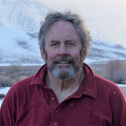
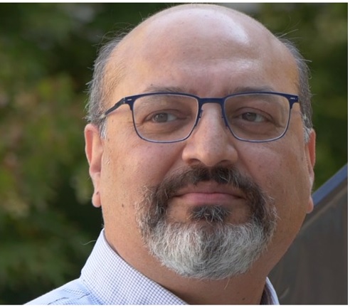
Dr. Jeff Dozier
Dr. Dozier has been on the UCSB faculty since 1974 and was the founding dean of the Bren School. He has led interdisciplinary studies in two areas: one addresses hydrologic science, environmental engineering, and social science in the water environment; the other is in the integration of environmental science and remote sensing with computer science and technology. From 1990-92, he was the senior project scientist for NASA’s Earth Observing System, when the configuration for the system was established. Among Dr. Dozier's honors are the 2009 Jim Gray Award from Microsoft for his achievements in data-intensive science and his selection as the 2010 Nye Lecturer for the Cryosphere group of the American Geophysical Union. A long-time backcountry skier, mountaineer, and rock climber, he helped lead six expeditions to the Hindu Kush range in Afghanistan and has a dozen first ascents there. The story behind the naming of Dozier Dome in the Sierra Nevada can be found in the Super Topo Climbing Forum.
Topic: Remote Sensing for Snow and Glaciers
June 26, 2024 (0400 – 0500 am UTC / 0930 – 1030 pm PST)
Dr. Prasad S. Thenkabail
Dr. Thenkabail has conducted pioneering research in hyperspectral remote sensing of vegetation and in that of global croplands and their water use for food security. In hyperspectral remote sensing he has done cutting-edge research with wide implications in advancing remote sensing science in application to agriculture and vegetation. This body of work led to more than ten peer-reviewed research publications with high impact. In studies of global croplands for food and water security, he has led the release of the world’s first Landsat-derived: 1. global cropland extent product @ 30m (GCEP30), and 2. global rainfed and irrigated area product @ 30m (LGRIP30). This work demonstrates a “paradigm shift” in how remote sensing science is conducted.
Topic: Mapping the World from Satellites to help us Understand and Manage Global Food and Water Security in the Twenty-first Century
July 02, 2024 (0930 – 1030 pm PST) / July 03, 2024 (0400 – 0500 am UTC)
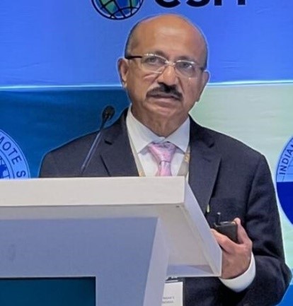
Dr. S. P. Aggarwal
Dr. Aggarwal is Director, North Eastern Space Applications Centre, Department of Space, India. He has taken important initiatives towards effective utilization of Space Science and Technology for various developmental activities of NER such as Natural Resource Management, Infrastructure Planning, Disaster Risk Management, Weather forecasting, Satellite communication applications, ICT based and Geo-governance related applications, etc. Prior to this assignment, he was the Group Head of Water Resources Department at Indian Institute of Remote Sensing (IIRS), ISRO, Dehradun. Dr. Aggarwal is a highly accomplished scientist in the field of Remote Sensing and GIS applications in water resources management, disaster management and climate change impact assessment and at the same time he has immensely contributed in the capacity building and outreach program of ISRO.
Topic: Geospatial Technology for Hydro-meteorological Disasters
July 12, 2024 (0930 – 1030 am UTC / 0130 - 0230 am PST / 0300 – 0400 pm IST)
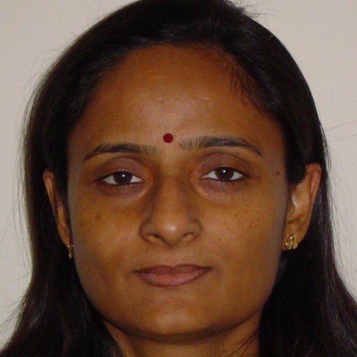
Dr. Rashmi Sharma
Dr. Sharma is presently Deputy Director, Earth, Ocean, Atmosphere, Planetary Sciences & Applications Area, Space Applications Centre, Indian Space Research Organisation, India. She is leading a team, which is engaged in carrying out advanced science activities related to Earth, and cutting edge research in the Planetary and Space sciences. Coordinating the activities for developing downstream applications using space-based observations, geospatial tools and advanced AI/ML technologies for various sectors like, agriculture, hydrology, weather, ocean and glaciers for societal benefit. She is steering various national level programs and coordinating activities with various ministries like, Ministry of Earth Sciences, Ministry of Agriculture and Farmer Welfare, and others. She has played key role in ISRO’s mission projects IRS-P4, SCATSAT-1, Oceansat-2, SARAL/AltiKa and Megha-Tropiques. Currently, she is leading two very important ISRO mission projects, namely Oceansat-3 as a Project Director (Utilization Program) for developing blue economy and NASA-ISRO upcoming project NISAR as a Science Lead primarily for earth deformation studies. As ISRO representative, she is serving in various international level committees.
She is recipient of prestigious P.R. Pisharoty Memorial Award, Satish Dhawan Award instituted by Indian Society of Remote Sensing. She is also recipient of ISRO’s Merit award and Team award. In the year 2022, she was Felicitated by CNBC-TV 18 as ISRO’s inspiring women in a program “Future Female Forward”. She has nearly 100 publications in national and international high impact peer reviewed journals. She has guided four PhD students. She is Associate Editor of Journal of the Indian Society of Remote Sensing (Springer).
Topic: Remote Sensing for Oceanography
July 24, 2024 (0930 – 1030 am UTC / 0130 - 0230 am PST / 0300 – 0400 pm IST)
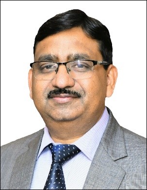
Dr. Parag Vaze
Mr. Parag Vaze is the assistant director for Earth Science at JPL and manager of the Surface Water Ocean Topography (SWOT), CRISTAL and Sentinel-6 project's at NASA's Jet Propulsion Laboratory (JPL). He has held technical and project management positions over 30 years at JPL on many Earth Science project (Topex/Poseidon, Jason-1, Jason-2, SWOT and Sentinel-6). Dr. Vaze is the chair of the International Astronautical Federation's GEOSS subcommittee. He holds a Bachelor of Science in Electrical Engineering from University of Pittsburgh and a Master of Science in computer science from Azusa Pacific University.
Topic: Recent Innovations in Remote Sensing for Oceans and Inland waters
July 30, 2024 (0930 – 1030 pm PST) / July 31, 2024 (0400 – 0500 am UTC)
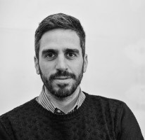
Dr. Christian Massari
Dr. Massari is currently Researcher at presso CONSIGLIO NAZIONALE DELLE RICERCHE – CNR, Perugia, Umbria, Italy. He has been conducting research in the field of hydraulic and hydrology focusing on topics that span from water resource management, flood forecasting, drought monitoring using land surface models and remote sensing data. He has developed works in these areas producing +80 contributions in peer reviewed hydrologic and hydraulic journals. His research interests include: Hydrological and land surface water balance modeling; Development of land data assimilation systems to ingest remote sensing retrievals; Microwave and radar remote sensing of soil moisture and precipitation; Drought monitoring and its relation with food production; Hydrological drought development; Supply pipe system diagnosis for the reduction of energy and water waste; Floods and drought hazards assessment through remote sensing information; Eco hydrology
Topic: Remote Sensing for Water Management and Droughts
August 07, 2024 (1030 – 1130 am UTC / 1230 – 1330 pm CET)
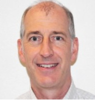
Dr. Mark Drinkwater
Dr. Mark Drinkwater Head, Earth & Mission Science Division, European Space Agency (ESA). ESA's Earth and Mission Science Division provides the scientific expertise during preparation, development and operation of ESA's Earth Observation satellite missions, including Research Missions (Earth Explorers), Operational Meteorology (MetOp), Earth Watch, and Copernicus Sentinel missions. He has over 30 years combined experience in research for NASA at the Jet Propulsion Laboratory, California Institute of Technology in Pasadena, USA, and for the European Space Agency (ESA) at ESTEC in Noordwijk, The Netherlands. He is specialised in Earth system science, using satellite remote sensing techniques, and have been responsible for scientific research projects in connection with successful NASA, JAXA and ESA satellite missions, including: SeaSat, SIR-C, NSCAT (ADEOS), SeaWinds (ADEOS-II), QuikScat, ERS-1, ERS-2, Envisat and MetOp. He has been Mission Scientist for the successful CryoSat, GOCE, and SMOS ESA Earth Explorer and Copernicus Sentinel-3 missions. He and his team continue providing support during SMOS, CryoSat, and Swarm mission operations whilst supporting the ongoing development of EarthCARE, Biomass, FLEX, FORUM and Harmony, together with ALTIUS, TRUTHS, Sentinel-4, Sentinel-5, six Copernicus Expansion Sentinels (CHIME, CIMR, CO2M, CRISTAL, LSTM, ROSE-L) and MetOp-Second Generation (MetOp-SG) and the Arctic Weather Satellite. They are currently involved in preparation of four future Earth Explorer 11 and 12 mission candidates, together with a second.cycle of Scout SmallSat mission ideas. He has following personal scientific expertise: cryosphere and climate, polar, ocean, gravity research, and airborne and in-situ campaigns using satellite remote sensing data.
Topic: ESA’s contributions to a global cryosphere observing system
August 14, 2024 (1030 – 1130 am UTC) / (1230 - 1330 CET)
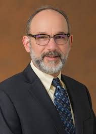
Dr. Paul Rosen
Dr. Paul Rosen (Fellow, IEEE) received the B.S. and M.S. degrees from the University of Pennsylvania, Philadelphia, PA, USA, in 1981 and 1982, respectively, and the Ph.D. degree from Stanford University, Stanford, CA, USA, in 1990, all in electrical engineering. He is currently the Project Scientist for NASA–ISRO Synthetic Aperture Radar (NISAR) mission at the Jet Propulsion Laboratory (JPL), California Institute of Technology, Pasadena, CA, where he is also a Visiting Faculty Member with the Division of Geological and Planetary Sciences. He is also the Study Coordinator for NASA’s Surface Deformation and Change Decadal Survey Architecture Study. His assignments at JPL have encompassed scientific and engineering research and development of radar instruments and applications, and technical, organizational, and programmatic management of radar developments at JPL. He has authored over more than 40 journal and book chapter publications and over 100 conference papers. Dr. Rosen currently serves as the IEEE Geoscience and Remote Sensing Society Director for Global Activities.
Topic: NISAR for Hydrosphere and Cryosphere
August 20, 2024 (2100 – 2200 pm PDT) / August 21, 2024 (0400 – 0500 am UTC)